WORKING LIVES ON THE MOOR
Craft, Community & Care Across the Centuries
A self‑guided circular walk for Heritage Open Days 2026
Start & Finish: Catley Lane Head, Rooley Moor Road, Rochdale OL12 6BN OS Grid Reference: SD 872 158
Distance: 3.9 miles (6.2 km)
Terrain: Moorland tracks, stone setts, gentle climbs
Difficulty: Moderate
Suitable for: Walkers and horse riders
Dogs: Welcome, but must be kept on a lead at all times as there is livestock on the moor
WELCOME
Rooley Moor is a landscape shaped by ordinary working people. Shepherds, smallholders, quarrymen, mill workers and commoners all left their mark on the moor, creating the heritage we see today. This circular walk explores their daily working lives and the traditions, crafts and routines that sustained upland communities for centuries.
It also highlights how responsible stewardship — by volunteers, conservation groups, commoners and the landowner — is required to protect the moor’s environment, history and heritage for future generations.
BEFORE YOU SET OFF
Getting There
We recommend starting the walk from Catley Lane Head village on Rooley Moor Road. There is ample roadside parking, but please park considerately. A regular bus service runs from Rochdale and Bury to Daniel Fold, from where it is a short uphill walk to the village.
Safety & Clothing
-
- Wear sturdy boots and warm waterproof clothing — the moor can be muddy and weather conditions change rapidly.
- In poor weather the route can be encased in cloud.
- Carry water and some food.
- There are no stiles, gates, bridges or stream crossings, but the ground is uneven.
Shared Use of the Moor
The moor is still actively farmed by the Commoners, so you may encounter livestock or farm vehicles. Dogs must be kept on a lead at all times.
Litter
Bins are located at the top and bottom of the village — please use them, including for dog waste.
Maps & GPX
Please download and print the route. Download the GPX file HERE, it can be used with your preferred GPS app.
THE ROUTE
1. CATLEY LANE HEAD — GATEWAY TO THE MOOR
Catley Lane Head marks the traditional entry point onto Rooley Moor. For centuries, families here relied on upland grazing, smallholdings and commoners’ rights to sustain their livelihoods. Daily life revolved around livestock, weather and shared responsibility for maintaining access routes and boundaries. Today, its designation as a conservation area recognises the hamlet’s rare survival of vernacular Pennine architecture, historic routes and landscape features, ensuring that this distinctive gateway to the moor is protected for future generations.
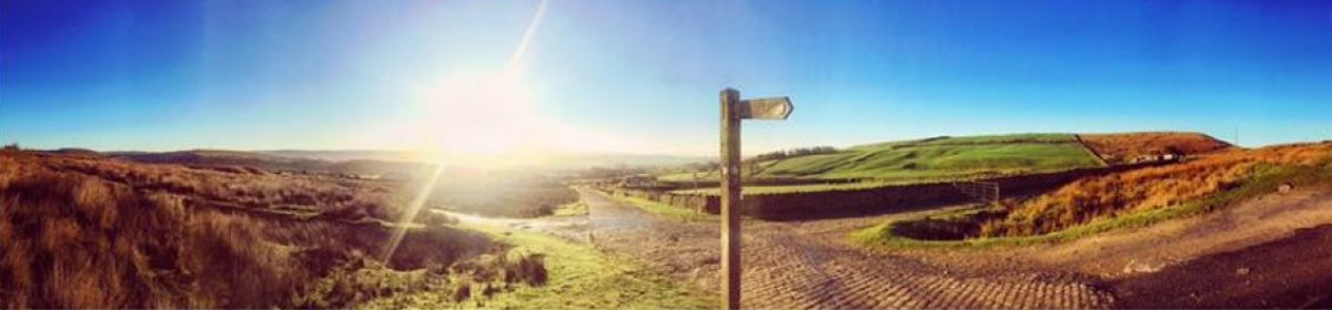
From Catley Lane Head, go over the cattle grid (which is near the BBC Plaque) and follow the track uphill. You will soon come to a crossroads, carry straight on here and through the yellow gate (this gate is to try to stop illegal use of motorised vehicles on the moor). Follow the now rougher track gradually uphill.
After just under half a mile you will come to the first stone setts of the Cotton Famine Road. There is a short section here before the track goes back to being rough again (there is a much longer section of stone setts which we will visit further on in the walk).
In another 0.2 miles you will come to a small track on the right (what3words location client.asleep.descended). You can make a short detour down this track to see the remains of Pike Brow Quarry on the left. If you then go to the right for a few hundred yards you will find Cat Stones Quarry. Retrace your steps to the main track and turn right uphill again.
2. UPLAND FARMING — WORKING THE LAND WITH CARE
Continue along the track until it levels out at the top of the hill. Look across the grazing land. Upland farming shaped Rooley Moor for generations. Shepherds followed seasonal routines, moving stock across the moor, repairing dry‑stone walls and managing water sources.
Modern grazing continues to support biodiversity and maintain the open character of the moor, echoing centuries of traditional practice.
3. THE COTTON FAMINE ROAD — CRAFT, CRISIS & GLOBAL CONNECTIONS
Continue to follow the track, here there is the much more extensive section of stone setts. Follow these stone setts laid during the Lancashire Cotton Famine of the 1860s, a crisis triggered by the American Civil War. The Union blockade of Confederate ports cut off raw cotton supplies, closing mills and leaving thousands of workers without wages.
Despite hardship, Lancashire mill workers famously supported the abolition of slavery, refusing to handle slave‑produced cotton even when it meant hunger at home. Their stance was recognised by President Abraham Lincoln, who thanked them for their “sublime Christian heroism.”
The Cotton Famine Road was built as a relief project. Many workers had never laid stone before, yet they learned the craft quickly — lifting, placing and hammering over 300,000 setts by hand.
The road stands as a testament to resilience, skill and community effort.
Its survival now depends on careful and responsible use.
4. THE MOORCOCK INN — A LOST LANDMARK
Follow the track for around half a mile to get to the site of the Moorcock Inn, once a well‑known upland hostelry serving travellers, quarrymen and local families. Although little remains today, the ruins can still be identified if you look closely.
The Moorcock Inn ruins are on the opposite side of the road, approximately 40 metres south of the two “Standing Stones”. If you pause here, you can make out the steps and ramp that once led to the main entrance — subtle but evocative traces of a building that played a central role in moorland life. There is also good view down to Greenbooth and Naden Reservoirs from here
5. PEAT, DRAINAGE & THE FRAGILITY OF THE MOOR
Unlike many upland areas, Rooley Moor saw limited peat‑cutting for fuel, as local families had access to coal from nearby pits. The greater impact came from drainage, where channels were cut to dry the moor for mining, quarrying, grazing or access. Over time, these drains exposed peat to erosion and weakened the blanket bog.
Peatlands are now recognised as vital carbon stores and biodiversity hotspots. A study commissioned by the Lancashire Peat Partnership identified Rooley Moor as one of the areas most likely to resist climate change and benefit from moorland restoration.
Protecting peat here is both an environmental and heritage responsibility.
At this point the walk turns around. If you wish you can continue to explore further up the Cotton Famine Road, then return to this point to re-join the route.
Walk back along the track for half a mile to get to the top of the hill and the end of the stone setts again.
Turn sharp right here up a rough track towards a pile of stones. This is Top of Pike, a good spot for a rest as it has extensive views in all directions.
6. MOORLAND ECOLOGY — A LIVING, CHANGING LANDSCAPE
As you continue the loop, notice the heather, grasses, watercourses and wildlife habitats. These features have been shaped by centuries of human activity — grazing, quarrying, walling, track‑building and drainage. Unfortunately, the illegal use of motorised vehicles on the moor is causing extensive environmental damage.
Today we would like to see conservation groups, commoners and volunteers work together to restore habitats, block old drains, improve water retention and protect the moor’s natural heritage.
Turn to the left just after the pile of stones and follow the path downhill. After a few hundred yards you will come to a junction of paths. Go straight on (the path curves slightly to the left). A good view opens up down over Greenbooth Reservoir all the way to Manchester in the distance. Follow this path downhill along the edge, with good views down to the right too.
The path curves away from the edge and joins another path, continue downhill until you come to a path crossroads near a dry stone wall (the wall is on your right). Turn left here (heading towards a distant phone mast on top of the hill) and follow this path until you reach a track.
Turn left along the track, when the track forks go right along a long straight section of track. Eventually you will come to a T junction, turn right here and follow the track back down to the start at Catley Lane Head.
7. RETURN TO CATLEY LANE HEAD — HERITAGE FOR TOMORROW
Rooley Moor’s working lives created the landscape we enjoy today. Its historic features, natural habitats and cultural traditions form a shared heritage that belongs to everyone who walks here.
Safeguarding this heritage for future generations requires active stewardship from local communities, volunteers, conservation bodies and, importantly, the landowner, whose decisions shape how the moor is managed and protected.
On Holcombe Moor we can see when landowners work in harmony with commoners, residents and heritage groups, the moor’s unique character can be preserved so future visitors can continue to read its history in the landscape.
Your walk ends where it began — at the gateway to a moor shaped by centuries of working lives, and now entrusted to those who value its environment, history and stories.